
29/03/2024 – ETAPA 1 | STAGE 1 -> LARGA (CASTILNEGRO – PUEBLA DE DON RODRIGO)

ETAPA 1 -> LARGA (CASTILNEGRO – PUEBLA DE DON RODRIGO)
Mapa “Castilnegro” (nuevo)
Localidad Puebla de Don Rodrigo
Distancia Larga
Extensión 7,4 km2
Escalas 1/15.000 – 1/10.000 – 1/7.500
Equidistancia 5 metros
Cartógrafos Mario Rodríguez Martínez
Altitud 500 – 700 m.
Trazador Jesús y Diego Rodríguez Corrochano
Últimos trazados: XV Trofeo Quijotes (Sigüenza)
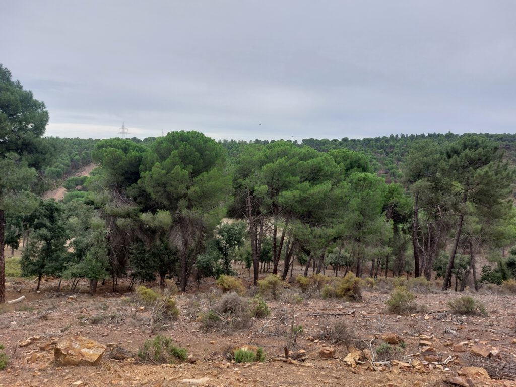
Terreno ideal para una Larga distancia, bosque en su mayoría blanco de buena carrera y visibilidad con grandes desniveles donde la elecciones de ruta y la forma física van a marcar la diferencia
Como límite de vegetación se ha usado el símbolo 416.001 (línea verde discontinua) para que se
distingan mejor ya que hay algunas zonas pedregosas y la línea de puntos de límite no se diferenciaría
de los puntos negros de la zona pedregosa
En las zonas de pino cuando hay pequeñas áreas de límites de vegetación suelen ser bosquecillos de
encinas y en las zonas de encinas pequeños bosquecillos de pinos
Las pequeñas zonas de verde claro suelen ser zonas de pequeñas encinas que dificultan la carrera y
visibilidad
En algunas zonas hay trabajos forestales y si hay demasiadas trochas y no muy distinguibles no están
representadas para ayudar a la legibilidad y navegación
Los elementos rocosos no son muy abundantes y los que hay representados no son de gran tamaño (1
m), en cambio cuando hay grandes rocas, son agujas muy altas, algunas de más de 4 m.
Hay que prestarle atención a las zonas pedregosas, las áreas de alta densidad de puntos son lentas
Trazadores: Diego y Jesús Rodríguez Corrochano
Servicios en el Centro de Competición
La empresa ATLAS Eventos que gestiona el Campamento de Puente de Retama nos cede de forma completamente desinteresada sus instalaciones. (bar cafetería, aseos y zona de aparcamiento) Desde la organización rogamos encarecidamente respetar el descanso e intimidad de las personas alojadas en el campamento así como el cuidado de las instalaciones
- ATLAS CAMPAMENTO DE RETAMA
o Aparcamiento (Coches y autocaravanas)
o Bar Cafetería
o Aseos - EN EL CENTRO DE COMPETICIÓN
o Secretaría
o Presalida
o TV
o Tiendas
▪ Tienda de Orientación
▪ X-Tyme
▪ Orienteering Obsession
o Servicios de emergencia - EXPLANADA GEACAM
o Aparcamiento (Autobuses y grandes autocaravanas)
o Restauración
▪ Migas manchegas

STAGE 1 -> LONG DISTANCE (CASTILNEGRO – PUEBLA DE DON RODRIGO)
Ideal terrain for a long distance, mostly white forest with good running and visibility with large slopes where route choices and physical fitness will make the difference.
The symbol 416.001 (dashed green line) has been used as the vegetation limit so that
distinguish better since there are some rocky areas and the line of limit points would not be differentiated
of the black dots of the stony area
In pine areas, when there are small areas of vegetation limits, they are usually groves of
oaks and in the oak areas small pine groves
The small areas of light green are usually areas of small oaks that make running difficult and
visibility
In some areas there is forestry work and if there are too many trails and not very distinguishable ones, they are not
represented to aid readability and navigation
The rock elements are not very abundant and those that are represented are not large in size (1
m), however, when there are large rocks, they are very tall needles, some more than 4 m.
You have to pay attention to rocky areas, areas with high density of points are slow
Tracers: Diego and Jesús Rodríguez Corrochano